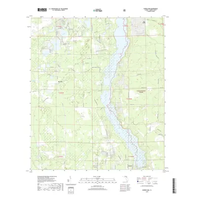
2018 Map of Eureka Dam
USGS Topo · Published 2018About this map
Lake Ocklawaha dominates the eastern landscape of this Marion County corridor, where the historic Eureka Dam stands near the settlement of Eureka. This 2018 survey captures a complex mosaic of freshwater systems and protected woodlands, with the Ocala National Forest spanning the eastern shore. The western half is defined by a dense cluster of named water bodies including Horseshoe Lake, Island Lake, and Stokes Lake, illustrating the characteristic karst topography of north-central Florida. Local history is anchored by Cornelius Cem in the north and the small community at Bay Lake, while the northern reaches include the distinct terrain of Hog Valley. The map detail follows the meandering course of Mill Cr and various millponds, such as Waldron Millpond, reflecting the area's long-standing connection to both water management and the timber resources of the surrounding forest.
Find a feature on this map
102 named features on this map. Tap any name to fly to it.
Don’t see what you’re looking for? This feature index may not catch every label — zoom into the map to look around manually.
Map Details
Editions of this 2018 Eureka Dam Map
This is the sole edition of this map. No revisions or reprints were ever made.
Other maps of this area

1893 · Citra
USGS Topo · 1:62,500

1895 · Citra
USGS Topo · 1:62,500

1915 · Interlachen
USGS Topo · 1:48,000

1916 · Interlachen
USGS Topo · 1:62,500

1938 · Hawthorn
USGS Topo · 1:48,000

1943 · Hawthorn
USGS Topo · 1:62,500

1944 · Interlachen
USGS Topo · 1:62,500

1949 · Keuka
USGS Topo · 1:24,000

1949 · Rodman
USGS Topo · 1:24,000

1949 · Interlachen
USGS Topo · 1:62,500