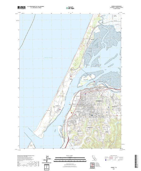
2021 Map of Eureka
USGS Topo · Published 2021About this map
The Samoa Peninsula separates the Pacific Ocean from the intricate waterways of Arcata Bay, creating a protected harbor that has shaped the character of coastal Humboldt County. On the mainland, the city of Eureka serves as a dense urban core, featuring the Humboldt County Courthouse and numerous residential districts like Myrtletown and Bayview. The map illustrates the complex marine infrastructure required to navigate these waters, including the Inner Reach, Outer Reach, and the Bar Channel leading toward the South Spit. Local history is preserved at the Myrtle Grove Memorial Cem and Oceanview Cem, while the industrial and recreational nature of the spit is visible through Samoa Field and the Mad River to North Spit Trl. Inland, the terrain transitions into sharp ravines like Henderson Gulch and Bob Hill Gulch.
Find a feature on this map
58 named features on this map. Tap any name to fly to it.
Don’t see what you’re looking for? This feature index may not catch every label — zoom into the map to look around manually.
Map Details
Editions of this 2021 Eureka Map
This is the sole edition of this map. No revisions or reprints were ever made.
Other maps of this area

1916 · Cape Fortunas
USGS Topo · 1:62,500

1922 · Eureka
USGS Topo · 1:62,500

1933 · Eureka
USGS Topo · 1:48,000

1942 · Eureka
USGS Topo · 1:62,500

1943 · Ferndale
USGS Topo · 1:62,500

1944 · Fortuna
USGS Topo · 1:62,500

1949 · Eureka
USGS Topo · 1:250,000

1951 · Eureka
USGS Topo · 1:62,500

1951 · Ferndale
USGS Topo · 1:62,500
1952 · Arcata North
USGS Topo · 1:24,000