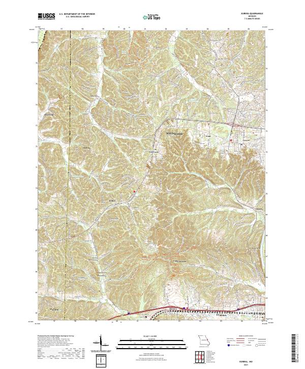
2021 Map of Eureka
USGS Topo · Published 2021About this map
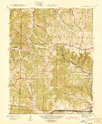
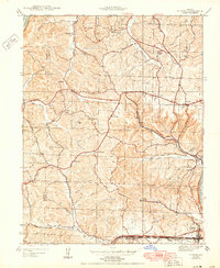
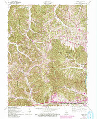
The Meramec River flows along the southern edge of this landscape, defining the transition from the river valley to the complex network of hollows and ridges that characterize the area west of St. Louis. The community of Eureka serves as a focal point near the river, situated adjacent to the BNSF Railway, which underscores the long-standing transportation corridor through the valley. To the north, the terrain transitions into the residential and educational developments of Wildwood, including the Saint Louis Community College Wildwood campus. Evidence of early settlement patterns remains visible in smaller locales like Glencoe, Allenton, and Pond, while the Allen Cem provides a specific point of interest for genealogical research. The varied topography is marked by distinctive drainages such as Wildhorse Cr and Hamilton Cr, alongside several named hollows like Spencer Harris Hollow and Coon Hollow that reflect the local geography.
Find a feature on this map
216 named features on this map. Tap any name to fly to it.
Don’t see what you’re looking for? This feature index may not catch every label — zoom into the map to look around manually.
Map Details
Editions of this 2021 Eureka Map
This is the sole edition of this map. No revisions or reprints were ever made.
Historical Maps of Wildwood Through Time
8 maps found