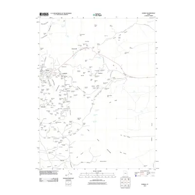
2010 Map of Eureka
USGS Topo · Published 2010About this map
The high-desert mining landscape of the Tintic District is defined by a dense network of shafts and tunnels surrounding the settlements of Eureka, Mammoth, and Knightville. By the early 21st century, the infrastructure of this storied silver-lead-zinc region remains a prominent feature of the terrain, from the Farragut Shaft in Fremont Canyon to the extensive workings at Dividend. The geography is characterized by steep ridges like Keystone Ridge and Latite Ridge, interspersed with numerous seasonal springs such as Hidden Treasure Spring and Big Gough Spring. Transport routes like Burriston Pass Rd and Dividend Rd weave through the mountains, connecting the historic mining centers with outlying claims like the Pinyon Queen and Water Lily. This survey documents the complex interface between the deep-vein mining operations and the rugged canyons of the East Tintic Mountains.
Find a feature on this map
210 named features on this map. Tap any name to fly to it.
Don’t see what you’re looking for? This feature index may not catch every label — zoom into the map to look around manually.
Map Details
Editions of this 2010 Eureka Map
This is the sole edition of this map. No revisions or reprints were ever made.
Other maps of this area

1885 · Salt Lake
USGS Topo · 1:250,000

1885 · Manti
USGS Topo · 1:250,000

1885 · Sevier Desert
USGS Topo · 1:250,000

1885 · Tooele Valley
USGS Topo · 1:250,000

1895 · Manti
USGS Topo · 1:250,000

1947 · Fivemile Pass
USGS Topo · 1:62,500

1947 · Allens Ranch
USGS Topo · 1:24,000

1947 · Boulter Peak
USGS Topo · 1:24,000

1949 · Eureka
USGS Topo · 1:24,000

1949 · Allens Ranch
USGS Topo · 1:24,000