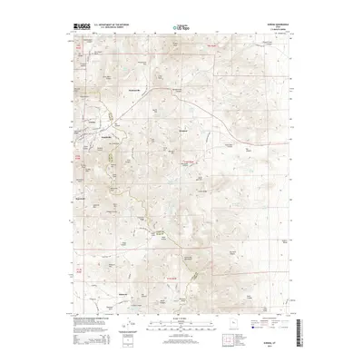
2014 Map of Eureka
USGS Topo · Published 2014About this map
The high-desert terrain of the East Tintic Mountains comes into sharp focus, centered on the historically significant mining town of Eureka. This area, crossing the boundary between Juab and Utah counties, is defined by a dense concentration of mining-era settlements and topological features that speak to the region's industrial heritage. From the streets of Mammoth and Knightville to the isolated site of Dividend, the map reveals how human habitation followed the mineral wealth of the ridges. Peaks such as Godiva Mtn and Mammoth Peak tower over a landscape dotted with vital water sources like Hidden Treasure Spring and Hattie Davis Spring. The subterranean infrastructure of the district is represented by the Tintic Drain Tunnel, which cuts through the geology near Goshen Valley. This survey captures the enduring layout of one of the West's most prolific mining districts, still shaped by its rugged topography.
Find a feature on this map
109 named features on this map. Tap any name to fly to it.
Don’t see what you’re looking for? This feature index may not catch every label — zoom into the map to look around manually.
Map Details
Editions of this 2014 Eureka Map
This is the sole edition of this map. No revisions or reprints were ever made.
Other maps of this area

1885 · Salt Lake
USGS Topo · 1:250,000

1885 · Manti
USGS Topo · 1:250,000

1885 · Sevier Desert
USGS Topo · 1:250,000

1885 · Tooele Valley
USGS Topo · 1:250,000

1895 · Manti
USGS Topo · 1:250,000

1947 · Fivemile Pass
USGS Topo · 1:62,500

1947 · Allens Ranch
USGS Topo · 1:24,000

1947 · Boulter Peak
USGS Topo · 1:24,000

1949 · Eureka
USGS Topo · 1:24,000

1949 · Allens Ranch
USGS Topo · 1:24,000