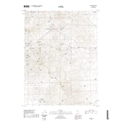
2020 Map of Eureka
USGS Topo · Published 2020About this map
Mining history and high-altitude settlements dominate this modern survey of the Tintic Mountains. Eureka and Mammoth serve as the primary hubs, with the surrounding hillsides dotted with remnants of the district's industrial past, including Dividend and the now-quiet Knightville. The topography is defined by significant elevations such as Godiva Mtn, Sioux Peak, and Mammoth Peak, which rise above deep cuts like Mammoth Gulch and Eagle Canyon.
Find a feature on this map
94 named features on this map. Tap any name to fly to it.
Don’t see what you’re looking for? This feature index may not catch every label — zoom into the map to look around manually.
Map Details
Editions of this 2020 Eureka Map
This is the sole edition of this map. No revisions or reprints were ever made.
Other maps of this area

1885 · Salt Lake
USGS Topo · 1:250,000

1885 · Manti
USGS Topo · 1:250,000

1885 · Sevier Desert
USGS Topo · 1:250,000

1885 · Tooele Valley
USGS Topo · 1:250,000

1895 · Manti
USGS Topo · 1:250,000

1947 · Fivemile Pass
USGS Topo · 1:62,500

1947 · Allens Ranch
USGS Topo · 1:24,000

1947 · Boulter Peak
USGS Topo · 1:24,000

1949 · Eureka
USGS Topo · 1:24,000

1949 · Allens Ranch
USGS Topo · 1:24,000