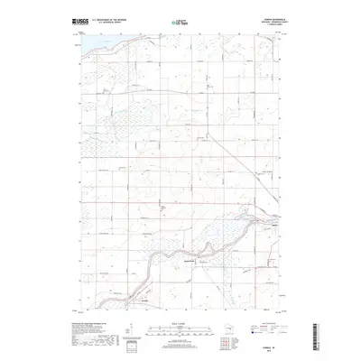
2018 Map of Eureka
USGS Topo · Published 2018About this map
The Fox River meanders through this portion of Winnebago County, defining the development of riverfront communities like Eureka and Omro. This survey illustrates a landscape shaped by water, where Hogers Bayou and Waukau Cr feed into the primary river system, and the southern shore of Lake Poygan reaches into the upper edge of the map. The terrain is notably characterized by Edgewater Ridge, rising above the surrounding wetlands and creek beds.
Find a feature on this map
68 named features on this map. Tap any name to fly to it.
Don’t see what you’re looking for? This feature index may not catch every label — zoom into the map to look around manually.
Map Details
Editions of this 2018 Eureka Map
This is the sole edition of this map. No revisions or reprints were ever made.
Other maps of this area

1916 · Ripon
USGS Topo · 1:48,000

1918 · Ripon
USGS Topo · 1:62,500

1955 · Green Bay
USGS Topo · 1:250,000

1956 · Ripon
USGS Topo · 1:62,500

1956 · Rosendale
USGS Topo · 1:62,500

1957 · Madison
USGS Topo · 1:250,000

1960 · Madison
USGS Topo · 1:250,000

1961 · Poy Sippi
USGS Topo · 1:62,500

1961 · Oshkosh
USGS Topo · 1:62,500

1961 · Lake Poygan
USGS Topo · 1:24,000