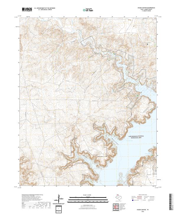
2022 Map of Evans Canyon
USGS Topo · Published 2022About this map
Lake Meredith National Recreation Area dominates this Moore County landscape, where the jagged eastern shoreline of Lake Meredith meets a complex network of draws and canyons. The terrain is deeply incised by drainage systems such as Evans Canyon, Martins Canyon, and Timber Hollow, which feed into the reservoir from the high plains. On the northeastern plateau, the Record Cem stands as a quiet marker of local genealogy above the Big Blue Cr drainage. Transport across this portion of the Panhandle is defined by a series of rural routes including FM 1913 and Blue West Rd, providing access to recreation points like Harbor Bay and hiking paths such as the South Turkey Creek Trl. The map illustrates the contemporary management of this water resource and its surrounding public lands.
Find a feature on this map
25 named features on this map. Tap any name to fly to it.
Don’t see what you’re looking for? This feature index may not catch every label — zoom into the map to look around manually.
Map Details
Editions of this 2022 Evans Canyon Map
This is the sole edition of this map. No revisions or reprints were ever made.
Other maps of this area

1936 · Fourways
USGS Topo · 1:62,500

1939 · Sanford
USGS Topo · 1:62,500

1953 · Sanford
USGS Topo · 1:24,000

1953 · Alibates Ranch
USGS Topo · 1:24,000

1953 · Evans Canyon
USGS Topo · 1:24,000

1953 · Deal
USGS Topo · 1:24,000

1953 · McDowell Creek
USGS Topo · 1:24,000

1953 · Spencer Draw
USGS Topo · 1:24,000

1954 · Amarillo
USGS Topo · 1:250,000

1958 · Amarillo
USGS Topo · 1:250,000