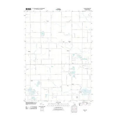
2011 Map of Evans
USGS Topo · Published 2011About this map
Harvard and Evans anchor this northern Kent County landscape, where glacial kettle lakes and small watercourses define the geography. The area is heavily marked by its spiritual and local history, as evidenced by a high density of burial grounds including Saint Margaret's Catholic Cemetery, Courtland Cemetery, and East Nelson Cemetery. The terrain is characterized by numerous small bodies of water such as Scram Lake, Cordes Lake, and Tamarack Lake, many of which remain connected by the winding Beaver Dam Creek and Coopers Creek. In the southern reaches, Wabasis Lake serves as a major landmark, supporting the Wabasis Park Campground and the nearby Wabasis Lake Airport. This network of rural roads and scattered settlements illustrates a transition into recreational and residential land use while maintaining the footprint of older agricultural and family-centered communities from previous generations.
Find a feature on this map
70 named features on this map. Tap any name to fly to it.
Don’t see what you’re looking for? This feature index may not catch every label — zoom into the map to look around manually.
Map Details
Editions of this 2011 Evans Map
This is the sole edition of this map. No revisions or reprints were ever made.
Other maps of this area

1918 · Cedar Springs
USGS Topo · 1:62,500

1943 · Cedar Springs
USGS Topo · 1:62,500

1954 · Midland
USGS Topo · 1:250,000

1958 · Midland
USGS Topo · 1:250,000

1958 · Sand Lake
USGS Topo · 1:62,500

1959 · Midland
USGS Topo · 1:250,000

1959 · Howard City
USGS Topo · 1:62,500

1966 · Midland
USGS Topo · 1:250,000

1967 · Cedar Springs
USGS Topo · 1:24,000
1967 · Rockford
USGS Topo · 1:24,000