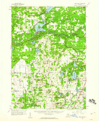
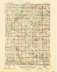
1958 Map of Sand Lake
USGS Topo · Published 1960About this map
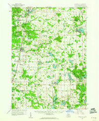
The Muskegon River and Little Muskegon River converge at the heart of this late-1950s survey, dominated by the waters of Croton Pond and Hardy Lake. The settlement of Croton sits at this hydro-industrial junction, surrounded by the wooded expanses of the Manistee National Forest. This era shows a landscape transitioning between working timberlands and recreational lakeside communities, where scattered lookout towers like the Croton Lookout Tower and Fish Lookout Tower still monitored the dense canopy.
Find a feature on this map
113 named features on this map. Tap any name to fly to it.
Don’t see what you’re looking for? This feature index may not catch every label — zoom into the map to look around manually.
Map Details
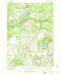
Editions of this 1958 Sand Lake Map
2 editions found
Other maps of this area
1918 · Cedar Springs
USGS Topo · 1:62,500
1943 · Cedar Springs
USGS Topo · 1:62,500
1945 · Ravenna
USGS Topo · 1:62,500

1954 · Midland
USGS Topo · 1:250,000

1958 · Midland
USGS Topo · 1:250,000
1958 · Fremont
USGS Topo · 1:62,500
1958 · Woodville
USGS Topo · 1:62,500
1958 · Big Rapids
USGS Topo · 1:62,500

1959 · Midland
USGS Topo · 1:250,000
1959 · Howard City
USGS Topo · 1:62,500
Featured Places
- Croton, Croton Township
- Sand Lake, Nelson Township
- Pierson, Pierson Township
- Aetna Township, MI
- Solon Township, MI