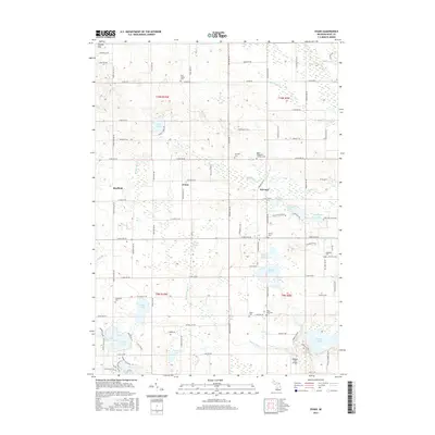
2017 Map of Evans
USGS Topo · Published 2017About this map
The glacial landscape of northern Kent County is defined by an intricate network of kettle lakes and wetlands, centered on the historic crossroads of Evans and Harvard. The map details a significant concentration of family and community burial grounds, including the Saint Margaret's Catholic Cem, De Graw Cem, and the East Nelson Cem to the north, which serve as vital markers for genealogical research in this rural region.
Find a feature on this map
105 named features on this map. Tap any name to fly to it.
Don’t see what you’re looking for? This feature index may not catch every label — zoom into the map to look around manually.
Map Details
Editions of this 2017 Evans Map
This is the sole edition of this map. No revisions or reprints were ever made.
Other maps of this area

1918 · Cedar Springs
USGS Topo · 1:62,500

1943 · Cedar Springs
USGS Topo · 1:62,500

1954 · Midland
USGS Topo · 1:250,000

1958 · Midland
USGS Topo · 1:250,000

1958 · Sand Lake
USGS Topo · 1:62,500

1959 · Midland
USGS Topo · 1:250,000

1959 · Howard City
USGS Topo · 1:62,500

1966 · Midland
USGS Topo · 1:250,000

1967 · Cedar Springs
USGS Topo · 1:24,000
1967 · Rockford
USGS Topo · 1:24,000