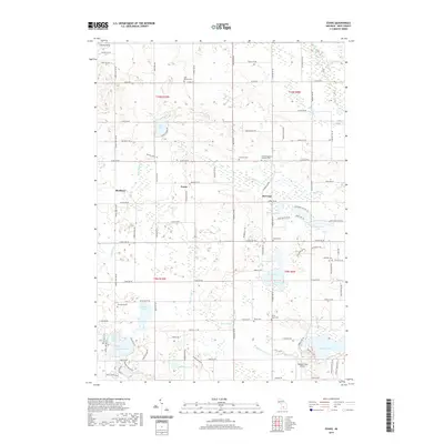
2019 Map of Evans
USGS Topo · Published 2019About this map
Harvard and Evans serve as the primary residential hubs in this portion of Kent County, situated within a landscape defined by an extensive network of small lakes and glacial depressions. The terrain shifts from the elevations of Cheney Hills in the northwest down toward a dense cluster of water bodies including Harvard Lake, Sandbottom Lake, and the large expanse of Wabasis Lake to the southeast. This 2019 survey documents a rural environment where land use is characterized by large agricultural tracts interspersed with clusters of lakefront development.
Find a feature on this map
104 named features on this map. Tap any name to fly to it.
Don’t see what you’re looking for? This feature index may not catch every label — zoom into the map to look around manually.
Map Details
Editions of this 2019 Evans Map
This is the sole edition of this map. No revisions or reprints were ever made.
Other maps of this area

1918 · Cedar Springs
USGS Topo · 1:62,500

1943 · Cedar Springs
USGS Topo · 1:62,500

1954 · Midland
USGS Topo · 1:250,000

1958 · Midland
USGS Topo · 1:250,000

1958 · Sand Lake
USGS Topo · 1:62,500

1959 · Midland
USGS Topo · 1:250,000

1959 · Howard City
USGS Topo · 1:62,500

1966 · Midland
USGS Topo · 1:250,000

1967 · Cedar Springs
USGS Topo · 1:24,000
1967 · Rockford
USGS Topo · 1:24,000