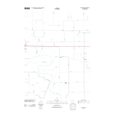
2013 Map of Evanston
USGS Topo · Published 2013About this map
The Des Moines River winds through this section of Webster County, carving a valley that separates the clustered settlements of Coalville and Evanston from the open agricultural plateaus to the north and east. The landscape reveals a mix of early industrial activity and modern infrastructure, notably at the Gypsum site near the western edge. Small, distinct communities like Judd, Border Plains, and Brushy anchor the rural road network, which follows a rigid section-line grid except where the topography of Prairie Cr and Holliday Cr forces more organic routes. This survey captures the region's managed hydrology, showcasing the transition from natural watercourses to engineered features like Lateral Number 1 and Drainage Ditch 19, which reflect the long-term transformation of the Iowa prairie into highly productive farmland while maintaining the older village footprints of the coal and gypsum eras.
Find a feature on this map
48 named features on this map. Tap any name to fly to it.
Don’t see what you’re looking for? This feature index may not catch every label — zoom into the map to look around manually.
Map Details
Editions of this 2013 Evanston Map
This is the sole edition of this map. No revisions or reprints were ever made.
Other maps of this area

1923 · Lehigh
USGS Topo · 1:62,500

1923 · Fort Dodge
USGS Topo · 1:62,500

1954 · Waterloo
USGS Topo · 1:250,000

1954 · Fort Dodge
USGS Topo · 1:250,000

1955 · Waterloo
USGS Topo · 1:250,000

1957 · Fort Dodge
USGS Topo · 1:250,000

1958 · Fort Dodge
USGS Topo · 1:250,000

1965 · Fort Dodge South
USGS Topo · 1:24,000

1965 · Lehigh
USGS Topo · 1:24,000

1965 · Harcourt
USGS Topo · 1:24,000