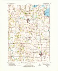
1961 Map of Evansville
USGS Topo · Published 1980About this map
Evansville and Oregon serve as the primary hubs in this region south of Madison, where the agricultural landscape is woven together by the Illinois Central RR and the Chicago and North Western railroads. The map highlights a rich network of rural infrastructure, from the Wisconsin School for Girls to scattered country schools like Peterson Sch and Franklin Sch. Water features define the northern reaches, particularly the expansive Lake Kegonsa and the winding Yahara River.
Find a feature on this map
83 named features on this map. Tap any name to fly to it.
Don’t see what you’re looking for? This feature index may not catch every label — zoom into the map to look around manually.
Map Details
Editions of this 1961 Evansville Map
2 editions found
Other maps of this area

1889 · Evansville
USGS Topo · 1:62,500

1890 · Madison
USGS Topo · 1:62,500

1890 · Sun Prairie
USGS Topo · 1:62,500

1890 · Stoughton
USGS Topo · 1:62,500

1891 · Janesville
USGS Topo · 1:62,500

1892 · Madison
USGS Topo · 1:62,500

1893 · Janesville
USGS Topo · 1:62,500

1893 · Brodhead
USGS Topo · 1:62,500

1894 · Evansville
USGS Topo · 1:62,500

1896 · Sun Prairie
USGS Topo · 1:62,500