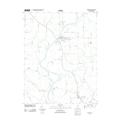
2012 Map of Evansville
USGS Topo · Published 2012About this map
The Kaskaskia River snakes through this 2012 survey, defining the central geography of Randolph County. The village of Evansville sits at a strategic bend in the river, where a network of local roads like Main St and Liberty St converge. Further south, the settlement of Ellis Grove serves as another focal point for the region's rural population. The landscape is marked by numerous small tributaries, including Plum Cr, Butter Cr, and the winding path of Ninemile Cr, which create a complex drainage pattern across the agricultural terrain.
Find a feature on this map
88 named features on this map. Tap any name to fly to it.
Don’t see what you’re looking for? This feature index may not catch every label — zoom into the map to look around manually.
Map Details
Editions of this 2012 Evansville Map
This is the sole edition of this map. No revisions or reprints were ever made.
Other maps of this area

1907 · Weingarten
USGS Topo · 1:62,500

1909 · Weingarten
USGS Topo · 1:62,500

1912 · Baldwin
USGS Topo · 1:62,500

1914 · Baldwin
USGS Topo · 1:62,500

1915 · Renault
USGS Topo · 1:62,500

1915 · Chester
USGS Topo · 1:62,500

1940 · Renault
USGS Topo · 1:62,500

1942 · Baldwin
USGS Topo · 1:62,500

1947 · Chester
USGS Topo · 1:62,500

1949 · Saint Louis
USGS Topo · 1:250,000