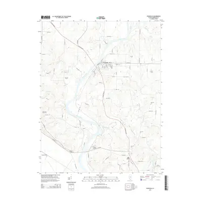
2015 Map of Evansville
USGS Topo · Published 2015About this map
The Kaskaskia River snakes through the heart of Randolph County, defining the agricultural and transport rhythms of Evansville and Ellis Grove. In this 2015 perspective, the landscape is a patchwork of river bottoms and wooded ridges, where the modern path of The Great River Rd follows the winding contours of the valley. Local family history is well-preserved in several rural burial grounds, including Saint Boniface Cem, Saint Peters Cem, and the Kelly Cem to the north. Aviation plays a unique role in this rural corridor, evidenced by both Riverveiw Airport and the Dale Curten Farm Airport. Further south, the map documents the smaller hubs of Roots and Collins near the confluence where Ninemile Creek meets the Kaskaskia, providing a detailed look at the infrastructure of small-town Illinois.
Find a feature on this map
88 named features on this map. Tap any name to fly to it.
Don’t see what you’re looking for? This feature index may not catch every label — zoom into the map to look around manually.
Map Details
Editions of this 2015 Evansville Map
This is the sole edition of this map. No revisions or reprints were ever made.
Other maps of this area

1907 · Weingarten
USGS Topo · 1:62,500

1909 · Weingarten
USGS Topo · 1:62,500

1912 · Baldwin
USGS Topo · 1:62,500

1914 · Baldwin
USGS Topo · 1:62,500

1915 · Renault
USGS Topo · 1:62,500

1915 · Chester
USGS Topo · 1:62,500

1940 · Renault
USGS Topo · 1:62,500

1942 · Baldwin
USGS Topo · 1:62,500

1947 · Chester
USGS Topo · 1:62,500

1949 · Saint Louis
USGS Topo · 1:250,000