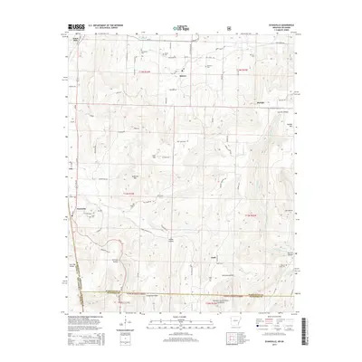
2014 Map of Evansville
USGS Topo · Published 2014About this map
Evansville and its surrounding mountain ridges define this borderland where Arkansas and Oklahoma meet. The landscape is characterized by narrow valleys and high ridges like Grapevine Ridge and Hale Mtn, which separate the various forks of the Baron Fork and Evansville Creek. This area is particularly rich for genealogists, featuring an unusually high density of family and community burial grounds, including Bethlehem Cem, English Cem, and Lewis Cem near the town center. Small settlements like Dutch Mills, Morrow, and Odell are connected by a network of winding roads such as Dutch Mills Rd and Hale Mountain Rd. To the south, the terrain becomes increasingly steep as it enters the Ozark National Forest, where deep hollows like Ashley Hollow and Tom Jack Hollow cut through the timbered highlands.
Find a feature on this map
79 named features on this map. Tap any name to fly to it.
Don’t see what you’re looking for? This feature index may not catch every label — zoom into the map to look around manually.
Map Details
Editions of this 2014 Evansville Map
This is the sole edition of this map. No revisions or reprints were ever made.
Other maps of this area

1898 · Winslow #3
USGS Topo · 1:62,500

1898 · Tahlequah
USGS Topo · 1:125,000

1898 · Winslow
USGS Topo · 1:125,000

1901 · Winslow
USGS Topo · 1:125,000

1901 · Tahlequah
USGS Topo · 1:125,000

1905 · Tahlequah
USGS Topo · 1:125,000

1946 · Fort Smith
USGS Topo · 1:250,000

1965 · Fort Smith
USGS Topo · 1:250,000

1967 · Fort Smith
USGS Topo · 1:250,000

1969 · Natural Dam
USGS Topo · 1:24,000