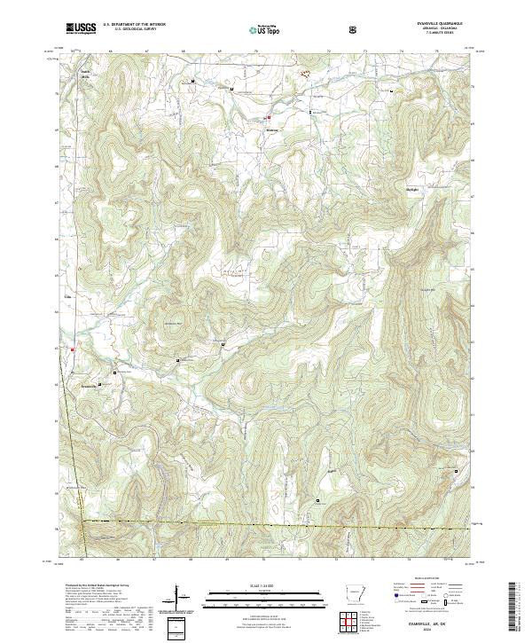
2024 Map of Evansville
USGS Topo · Published 2024About this map
Evansville and Dutch Mills anchor this topographic view of the Arkansas-Oklahoma borderlands in Washington and Crawford Counties. The landscape is defined by the high ridges of Skylight Mtn and Anderson Mtn, where numerous family and community cemeteries speak to the deep-rooted settlement patterns of the Ozark foothills. Genealogists will find a high concentration of burial sites, including Bethlehem Cem, Academy Cem, and Garrett Creek Cem, often located near the winding headwaters of Evansville Creek and Fly Creek.
Find a feature on this map
75 named features on this map. Tap any name to fly to it.
Don’t see what you’re looking for? This feature index may not catch every label — zoom into the map to look around manually.
Map Details
Editions of this 2024 Evansville Map
This is the sole edition of this map. No revisions or reprints were ever made.
Other maps of this area

1898 · Winslow #3
USGS Topo · 1:62,500

1898 · Tahlequah
USGS Topo · 1:125,000

1898 · Winslow
USGS Topo · 1:125,000

1901 · Winslow
USGS Topo · 1:125,000

1901 · Tahlequah
USGS Topo · 1:125,000

1905 · Tahlequah
USGS Topo · 1:125,000

1946 · Fort Smith
USGS Topo · 1:250,000

1965 · Fort Smith
USGS Topo · 1:250,000

1967 · Fort Smith
USGS Topo · 1:250,000

1969 · Natural Dam
USGS Topo · 1:24,000