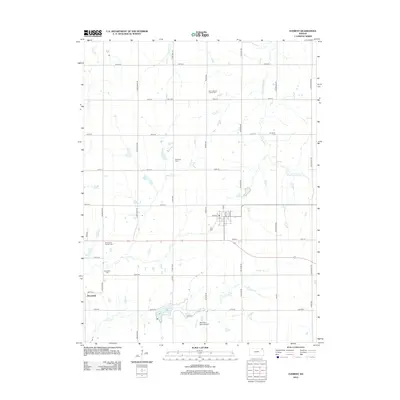
2012 Map of Everest
USGS Topo · Published 2012About this map
The settlement of Kennekuk and the surrounding agricultural landscape in Brown County define this 2012 survey. The area is marked by a high density of rural burial grounds, including Zion Lutheran Church Cem, Saint Leo's Catholic Cem, and All Saints Cem, which speak to the deep generational roots of the local community. The drainage patterns of the S Fork Wolf River and Otter Cr dictate the layout of the section-line road network, which remains largely intact. In the southern portion of the quadrangle, Clear Creek Lake and the Bent Nail Ranch Airport provide modern landmarks alongside the historic sites of the Kennekuk Cem and the Carr Cem. The map illustrates a stable, rural Kansas environment where early pioneer lineage and modern infrastructure coexist across the prairie.
Find a feature on this map
46 named features on this map. Tap any name to fly to it.
Don’t see what you’re looking for? This feature index may not catch every label — zoom into the map to look around manually.
Map Details
Editions of this 2012 Everest Map
This is the sole edition of this map. No revisions or reprints were ever made.
Other maps of this area

1885 · Atchison
USGS Topo · 1:125,000

1888 · Atchison
USGS Topo · 1:125,000

1888 · Hiawatha
USGS Topo · 1:125,000

1893 · Atchison
USGS Topo · 1:125,000

1894 · Hiawatha
USGS Topo · 1:125,000

1950 · Kansas City
USGS Topo · 1:250,000

1954 · Kansas City
USGS Topo · 1:250,000

1956 · Kansas City
USGS Topo · 1:250,000
1959 · Highland
USGS Topo · 1:24,000

1960 · Kansas City
USGS Topo · 1:250,000