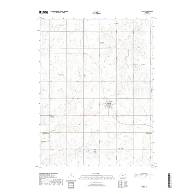
2018 Map of Everest
USGS Topo · Published 2018About this map
Everest serves as the primary hub of this northeastern Kansas landscape, situated near the intersection of 110th St and Main St. The surrounding countryside is defined by a dense network of sectional roads and established cemeteries that reflect the area's long-standing rural community structure. Notable burial sites include Zion Lutheran Church Cem and Saint Leo's Catholic Cem, while the settlement of Kennekuk sits further southwest near the border of Brown Co and Atchison Co.
Find a feature on this map
51 named features on this map. Tap any name to fly to it.
Don’t see what you’re looking for? This feature index may not catch every label — zoom into the map to look around manually.
Map Details
Editions of this 2018 Everest Map
This is the sole edition of this map. No revisions or reprints were ever made.
Other maps of this area

1885 · Atchison
USGS Topo · 1:125,000

1888 · Atchison
USGS Topo · 1:125,000

1888 · Hiawatha
USGS Topo · 1:125,000

1893 · Atchison
USGS Topo · 1:125,000

1894 · Hiawatha
USGS Topo · 1:125,000

1950 · Kansas City
USGS Topo · 1:250,000

1954 · Kansas City
USGS Topo · 1:250,000

1956 · Kansas City
USGS Topo · 1:250,000
1959 · Highland
USGS Topo · 1:24,000

1960 · Kansas City
USGS Topo · 1:250,000