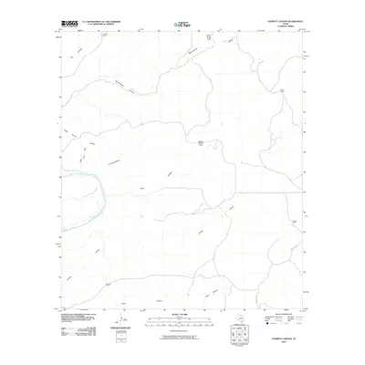
2010 Map of Everett Canyon
USGS Topo · Published 2010About this map
The Pecos River cuts through this arid landscape in Val Verde County, defining a topography dominated by steep drainages and isolated ranching outposts. Settled life centers on family-named holdings such as Mayfield Ranch, Everett Ranch, and Ward Ranch, which dot the uplands between complex canyon systems. The map illustrates the region's reliance on private airstrips and remote road networks, featuring the Rancho Grande Airport and Blue Hills Rd. Extensive natural features like Live Oak Canyon, Oppenheimer Canyon, and Zixto Canyon carve through the limestone terrain, illustrating the dramatic erosional patterns typical of the Trans-Pecos borderlands. From the small settlement of Boyd in the south to the northern ranchlands, this map reveals the infrastructure required to manage these large-scale livestock operations in the early 21st century.
Find a feature on this map
18 named features on this map. Tap any name to fly to it.
Don’t see what you’re looking for? This feature index may not catch every label — zoom into the map to look around manually.
Map Details
Editions of this 2010 Everett Canyon Map
This is the sole edition of this map. No revisions or reprints were ever made.
Other maps of this area

1943 · Langtry
USGS Topo · 1:62,500

1943 · Shumla
USGS Topo · 1:62,500

1954 · Sonora
USGS Topo · 1:250,000

1958 · Sonora
USGS Topo · 1:250,000

1958 · Del Rio
USGS Topo · 1:250,000

1964 · Del Rio
USGS Topo · 1:250,000

1970 · Everett Canyon
USGS Topo · 1:24,000

1970 · Pandale
USGS Topo · 1:24,000

1970 · Steel Star Draw
USGS Topo · 1:24,000

1970 · Little Fielder Draw
USGS Topo · 1:24,000