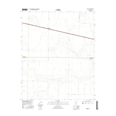
2016 Map of Everett
USGS Topo · Published 2016About this map
Everett sits at a critical junction of high plains transport and drainage in the Texas Panhandle. This survey illustrates a landscape defined by the intersection of modern infrastructure and natural hydrology, where the I- 40 Svc Rd cuts across the northern terrain while the seasonal waters of N Palo Duro Cr carve through the southern sections. The map serves as a detailed record of the borderlands between Oldham and Deaf Smith counties, an area characterized by a grid of rural roads such as Everett Rd and Co Rd F that serve isolated ranching interests. To the east, Montgomery Lake and its surrounding wetlands provide a rare perennial water feature in this otherwise semi-arid environment, anchoring the local geography for researchers studying the historical land use and environmental changes of the region.
Find a feature on this map
17 named features on this map. Tap any name to fly to it.
Don’t see what you’re looking for? This feature index may not catch every label — zoom into the map to look around manually.
Map Details
Editions of this 2016 Everett Map
This is the sole edition of this map. No revisions or reprints were ever made.
Other maps of this area

1934 · Ady
USGS Topo · 1:62,500

1936 · Ady
USGS Topo · 1:62,500

1954 · Tucumcari
USGS Topo · 1:250,000

1958 · Tucumcari
USGS Topo · 1:250,000

1962 · Wildorado
USGS Topo · 1:62,500

1965 · Everett
USGS Topo · 1:24,000

1965 · Allison Ranch
USGS Topo · 1:24,000

1966 · Jay Taylor Ranch
USGS Topo · 1:24,000

1966 · Rotten Hill
USGS Topo · 1:24,000

1966 · Vega South
USGS Topo · 1:24,000