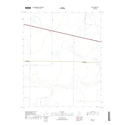
2019 Map of Everett
USGS Topo · Published 2019About this map
Everett sits at a high-plains crossroads in the Texas Panhandle, defined by the long horizon of the Llano Estacado. This 2019 survey captures a landscape where modern infrastructure meets seasonal hydrology, with the town positioned along the I-40 SVC RD and the main interstate corridor. To the east, the terrain breaks at the headwaters of N Palo Duro Cr, which carves a distinct drainage pattern across the plateau toward Montgomery Lake. This boundary area, where the Oldham County and Deaf Smith County lines meet, is gridded by local connectors like Everett Rd and Co RD 26, reflecting the systematic agricultural and ranching layout of the region. The map highlights the transition from the flat tableland to the more varied topography of the Palo Duro draws.
Find a feature on this map
17 named features on this map. Tap any name to fly to it.
Don’t see what you’re looking for? This feature index may not catch every label — zoom into the map to look around manually.
Map Details
Editions of this 2019 Everett Map
This is the sole edition of this map. No revisions or reprints were ever made.
Other maps of this area

1934 · Ady
USGS Topo · 1:62,500

1936 · Ady
USGS Topo · 1:62,500

1954 · Tucumcari
USGS Topo · 1:250,000

1958 · Tucumcari
USGS Topo · 1:250,000

1962 · Wildorado
USGS Topo · 1:62,500

1965 · Everett
USGS Topo · 1:24,000

1965 · Allison Ranch
USGS Topo · 1:24,000

1966 · Jay Taylor Ranch
USGS Topo · 1:24,000

1966 · Rotten Hill
USGS Topo · 1:24,000

1966 · Vega South
USGS Topo · 1:24,000