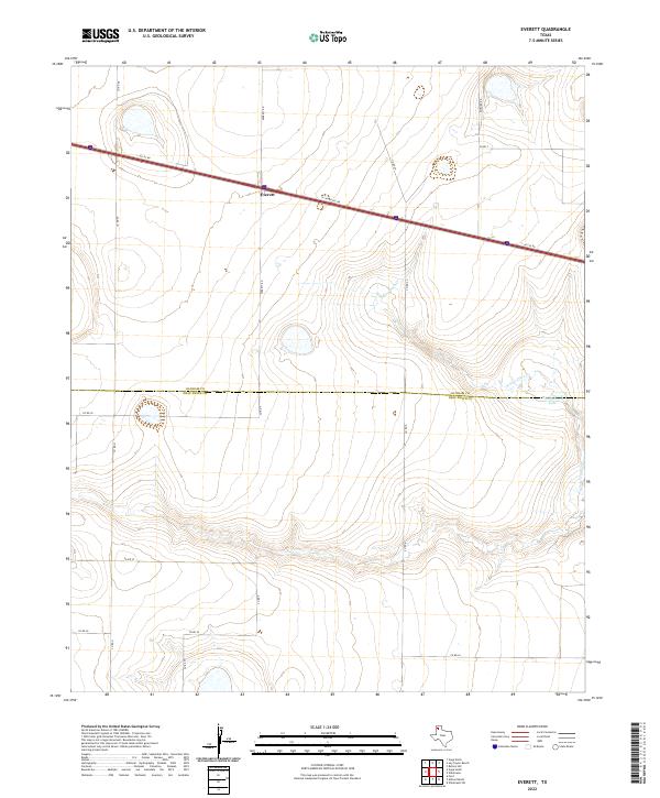
2022 Map of Everett
USGS Topo · Published 2022About this map
The settlement of Everett sits at the intersection of Everett Rd and the I-40 Svc Rd, serving as a central point in this High Plains landscape. This 2022 survey captures the transition between the rolling ranch land and the canyon systems formed by N Palo Duro Cr, which cuts through the eastern portion of the quadrangle. The map highlights the jurisdictional boundary between Oldham Co and Deaf Smith Co, a line that divides the open rangeland just south of the interstate corridor. Notable water features like Montgomery Lake provide rare hydrologic markers in this semi-arid environment, while a network of county roads including Binford Rd and Co Rd G connects the remote holdings of the Panhandle. The terrain is defined by dramatic contour changes as the land drops toward the creek bed, illustrating the erosive power of the local drainage systems.
Find a feature on this map
17 named features on this map. Tap any name to fly to it.
Don’t see what you’re looking for? This feature index may not catch every label — zoom into the map to look around manually.
Map Details
Editions of this 2022 Everett Map
This is the sole edition of this map. No revisions or reprints were ever made.
Other maps of this area

1934 · Ady
USGS Topo · 1:62,500

1936 · Ady
USGS Topo · 1:62,500

1954 · Tucumcari
USGS Topo · 1:250,000

1958 · Tucumcari
USGS Topo · 1:250,000

1962 · Wildorado
USGS Topo · 1:62,500

1965 · Everett
USGS Topo · 1:24,000

1965 · Allison Ranch
USGS Topo · 1:24,000

1966 · Jay Taylor Ranch
USGS Topo · 1:24,000

1966 · Rotten Hill
USGS Topo · 1:24,000

1966 · Vega South
USGS Topo · 1:24,000