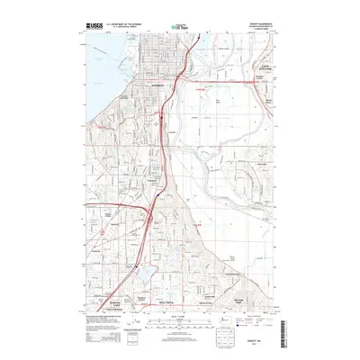
2014 Map of Everett
USGS Topo · Published 2014About this map
The industrial waterfront of Everett and the complex hydrology of the Snohomish River delta define this 2014 study of Snohomish County. The deep-water facilities at the Everett Shipyard Piers on East Waterway Port Gardner connect the city to Possession Sound, while the eastern portion of the map is dominated by the intricate network of the river and its sloughs. Features like Steamboat Slough, Ebey Slough, and Deadwater Slough surround Ebey Island, illustrating a landscape managed for both agriculture and flood control.
Find a feature on this map
81 named features on this map. Tap any name to fly to it.
Don’t see what you’re looking for? This feature index may not catch every label — zoom into the map to look around manually.
Map Details
Editions of this 2014 Everett Map
This is the sole edition of this map. No revisions or reprints were ever made.
Other maps of this area

1895 · Snohomish
USGS Topo · 1:125,000

1897 · Seattle
USGS Topo · 1:125,000

1911 · Mount Vernon
USGS Topo · 1:125,000

1941 · Marysville
USGS Topo · 1:62,500

1942 · Edmonds
USGS Topo · 1:62,500

1943 · Marysville
USGS Topo · 1:62,500

1943 · Stanwood
USGS Topo · 1:62,500

1944 · Everett
USGS Topo · 1:62,500
1953 · Bothell
USGS Topo · 1:24,000
1953 · Maltby
USGS Topo · 1:24,000