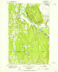
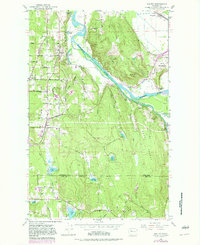
1953 Map of Maltby
USGS Topo · Published 1955About this map
Paradise Valley and the surrounding Snohomish County hillsides characterize this mid-century portrait of a landscape defined by its waterways and institutions. The confluence of the Snohomish River, Skykomish River, and Snoqualmie River dominates the eastern half of the quadrangle, creating a complex drainage network that includes Crescent Lake and Lake Beecher. This hydrology is mirrored in the upland areas, where numerous small bodies of water like Crystal Lake, Shadow Lake, and Paradise Lake dot the terrain.
Find a feature on this map
44 named features on this map. Tap any name to fly to it.
Don’t see what you’re looking for? This feature index may not catch every label — zoom into the map to look around manually.
Map Details
Editions of this 1953 Maltby Map
5 editions found
Other maps of this area

1895 · Snohomish
USGS Topo · 1:125,000

1897 · Seattle
USGS Topo · 1:125,000

1921 · Sultan
USGS Topo · 1:125,000

1923 · Sultan
USGS Topo · 1:125,000

1944 · Everett
USGS Topo · 1:62,500

1950 · Redmond
USGS Topo · 1:24,000

1950 · Kirkland
USGS Topo · 1:24,000

1953 · Monroe
USGS Topo · 1:24,000
1953 · Bothell
USGS Topo · 1:24,000
1953 · Snohomish
USGS Topo · 1:24,000