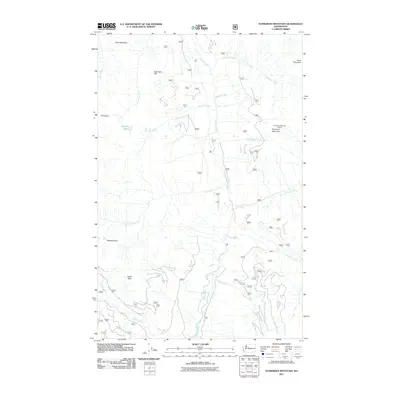
2011 Map of Evergreen Mountain
USGS Topo · Published 2011About this map
Evergreen Mountain Lookout stands as a prominent sentinel overlooking this high-elevation corner of Washington's Cascades, where the Beckler River system drains the surrounding peaks. The landscape is defined by its dramatic relief, moving from the sharp summit of El Capitan in the west to Silica Mountain in the east. Numerous tributaries, including Boulder Creek, Windfall Creek, and Harlan Creek, carve through the terrain to meet the river.
Find a feature on this map
24 named features on this map. Tap any name to fly to it.
Don’t see what you’re looking for? This feature index may not catch every label — zoom into the map to look around manually.
Map Details
Editions of this 2011 Evergreen Mountain Map
This is the sole edition of this map. No revisions or reprints were ever made.
Other maps of this area

1902 · Skykomish
USGS Topo · 1:125,000

1905 · Skykomish
USGS Topo · 1:125,000

1957 · Wenatchee
USGS Topo · 1:250,000

1965 · Captain Point
USGS Topo · 1:24,000

1965 · Evergreen Mtn
USGS Topo · 1:24,000

1965 · Grotto
USGS Topo · 1:24,000

1965 · Monte Cristo
USGS Topo · 1:24,000

1965 · Skykomish
USGS Topo · 1:24,000
1965 · Bench Mark Mtn
USGS Topo · 1:24,000
1965 · Baring
USGS Topo · 1:24,000