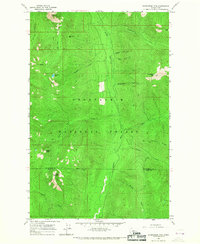
1965 Map of Evergreen Mtn
USGS Topo · Published 1967About this map
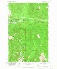
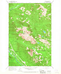
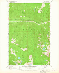
Evergreen Mtn and its Lookout tower rise as the central focal point within the Snoqualmie National Forest, marking a landscape of significant relief in the North Cascades. The 1965 survey reveals a complex network of high-elevation peaks, from the dramatic El Capitan in the west to the southern formation of Eagle Rock. This region, split by the boundary of Snohomish County and King County, is defined by its drainage basins, where the Rapid River and Beckler River gather runoff from numerous tributaries like Bullbucker Creek and Johnson Creek.
Find a feature on this map
28 named features on this map. Tap any name to fly to it.
Don’t see what you’re looking for? This feature index may not catch every label — zoom into the map to look around manually.
Map Details
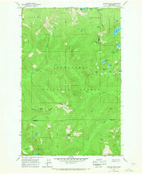
Editions of this 1965 Evergreen Mtn Map
2 editions found

Other maps of this area

1902 · Skykomish
USGS Topo · 1:125,000

1905 · Skykomish
USGS Topo · 1:125,000

1957 · Wenatchee
USGS Topo · 1:250,000
1965 · Captain Point
USGS Topo · 1:24,000
1965 · Grotto
USGS Topo · 1:24,000
1965 · Monte Cristo
USGS Topo · 1:24,000
1965 · Skykomish
USGS Topo · 1:24,000

1965 · Bench Mark Mtn
USGS Topo · 1:24,000
1965 · Baring
USGS Topo · 1:24,000
1965 · Scenic
USGS Topo · 1:24,000