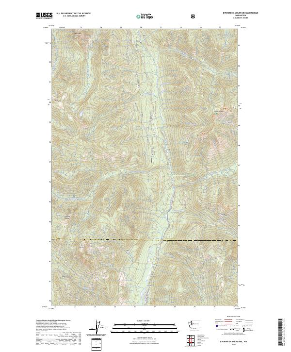
2023 Map of Evergreen Mountain
USGS Topo · Published 2023About this map
Henry M Jackson Wilderness and Wild Sky Wilderness converge in this high-altitude landscape within the Snoqualmie National Forest. The geography is defined by the central corridor of the Beckler River, which draws tributaries like Evergreen Creek and Johnson Creek from the surrounding ridges. Prominent peaks such as Evergreen Mountain and San Juan Hill dominate the skyline, providing a backdrop for Boulder Lake and the drainage of the Rapid River. This modern survey illustrates the conservation-focused management of the Cascade Range, where the Snohomish County and King County line crosses through backcountry terrain marked by the Evergreen Mtn Trl and the Beckler Road Trl.
Find a feature on this map
35 named features on this map. Tap any name to fly to it.
Don’t see what you’re looking for? This feature index may not catch every label — zoom into the map to look around manually.
Map Details
Editions of this 2023 Evergreen Mountain Map
This is the sole edition of this map. No revisions or reprints were ever made.
Other maps of this area

1902 · Skykomish
USGS Topo · 1:125,000

1905 · Skykomish
USGS Topo · 1:125,000

1957 · Wenatchee
USGS Topo · 1:250,000

1965 · Captain Point
USGS Topo · 1:24,000

1965 · Evergreen Mtn
USGS Topo · 1:24,000

1965 · Grotto
USGS Topo · 1:24,000

1965 · Monte Cristo
USGS Topo · 1:24,000

1965 · Skykomish
USGS Topo · 1:24,000
1965 · Bench Mark Mtn
USGS Topo · 1:24,000
1965 · Baring
USGS Topo · 1:24,000