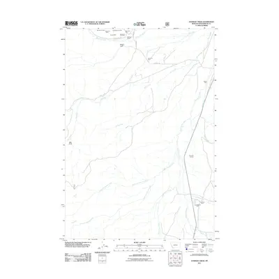
2011 Map of Everson Creek
USGS Topo · Published 2011About this map
Bloody Dick Creek flows through the northern reaches of this Beaverhead County landscape, an area defined by long-standing cattle ranching and historic mining operations. In the early 21st century, the working character of the land remains evident through family holdings like JS Brenner Ranch and Donovan Ranch. The northern hills around Sullivan Gulch are punctuated by several mineral claims, including the Starlight Mine, Bloody Dick Creek Mine, and Monument Mine, reflecting the region's enduring connection to extraction. Further south, the landscape is shaped by the drainage of Horse Prairie Creek and its many tributaries, such as North Fork Everson Creek and Black Canyon Creek. Infrastructure like the Donovan Airstrip and Confederate Dam underscore the local management of this expansive high-country environment.
Find a feature on this map
30 named features on this map. Tap any name to fly to it.
Don’t see what you’re looking for? This feature index may not catch every label — zoom into the map to look around manually.
Map Details
Editions of this 2011 Everson Creek Map
This is the sole edition of this map. No revisions or reprints were ever made.
Other maps of this area

1955 · Dubois
USGS Topo · 1:250,000

1955 · Dillon
USGS Topo · 1:250,000

1957 · Dillon
USGS Topo · 1:250,000

1958 · Dubois
USGS Topo · 1:250,000

1958 · Dillon
USGS Topo · 1:250,000

1959 · Grant
USGS Topo · 1:62,500

1962 · Dillon
USGS Topo · 1:250,000

1965 · Dillon
USGS Topo · 1:250,000

1965 · Deadman Pass
USGS Topo · 1:24,000

1965 · Jeff Davis Peak
USGS Topo · 1:24,000