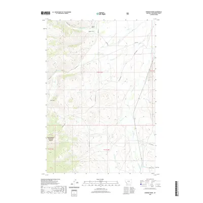
2020 Map of Everson Creek
USGS Topo · Published 2020About this map
Beaverhead National Forest defines the western reaches of this high-elevation landscape, where the Continental Divide meets the historic transit routes of the American West. The crossing at Lemhi Pass stands as the primary landmark, served by the winding Lemhi Pass Rd. The drainage patterns are complex, with waters flowing through Bloody Dick Cr and Horse Prairie Cr, while the southern portion of the quadrangle is marked by Jeff Davis Cr and Maiden Cr. This network of creeks and gulches, including Sullivan Gulch and Magpie Gulch, illustrates the transition from high mountain passes to the broader valley floors. Cultural footprints are visible in the naming of local routes such as China Town Rd and Maiden Creek RD, which point to the region's 19th-century mining and settlement legacy.
Find a feature on this map
29 named features on this map. Tap any name to fly to it.
Don’t see what you’re looking for? This feature index may not catch every label — zoom into the map to look around manually.
Map Details
Editions of this 2020 Everson Creek Map
This is the sole edition of this map. No revisions or reprints were ever made.
Other maps of this area

1955 · Dubois
USGS Topo · 1:250,000

1955 · Dillon
USGS Topo · 1:250,000

1957 · Dillon
USGS Topo · 1:250,000

1958 · Dubois
USGS Topo · 1:250,000

1958 · Dillon
USGS Topo · 1:250,000

1959 · Grant
USGS Topo · 1:62,500

1962 · Dillon
USGS Topo · 1:250,000

1965 · Dillon
USGS Topo · 1:250,000

1965 · Deadman Pass
USGS Topo · 1:24,000

1965 · Jeff Davis Peak
USGS Topo · 1:24,000