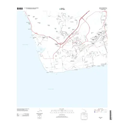
2013 Map of Ewa
USGS Topo · Published 2013About this map
Kapolei and the surrounding Ewa Plain are depicted during a period of significant urban transition, where the legacy of the sugar industry meets modern development. The map shows a series of historic camps or "villages" including Tenney Village, Fernandez Village, and Renton Village, which speak to the area's plantation heritage. These residential clusters sit alongside modern infrastructure like Kalaeloa Airport (John Rodgers Field) and the Hawaii Raceway Park.
Find a feature on this map
55 named features on this map. Tap any name to fly to it.
Don’t see what you’re looking for? This feature index may not catch every label — zoom into the map to look around manually.
Map Details
Editions of this 2013 Ewa Map
This is the sole edition of this map. No revisions or reprints were ever made.
Other maps of this area

1953 · Schofield Barracks
USGS Topo · 1:24,000

1953 · Ewa
USGS Topo · 1:24,000

1953 · Puuloa
USGS Topo · 1:24,000

1954 · Oahu
USGS Topo · 1:250,000

1954 · Waianae
USGS Topo · 1:24,000

1954 · Waipahu
USGS Topo · 1:24,000

1959 · Waipahu
USGS Topo · 1:24,000
1959 · Puuloa
USGS Topo · 1:24,000

1960 · Schofield Barracks
USGS Topo · 1:24,000

1961 · Oahu
USGS Topo · 1:250,000