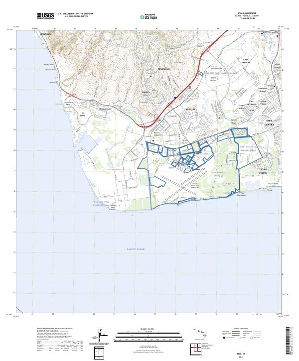
2024 Map of Ewa
USGS Topo · Published 2024About this map
'Ewa Villages and the surrounding coastal plains of West O'ahu are presented here in high detail, reflecting the transition from historic plantation settlements to modern residential centers. The map preserves the distinct layout of several traditional residential clusters including Varona Village, Tenney Village, Fernandez Village, and Renton Village, often associated with the region’s agricultural history near the Ewa Community Cem. This survey illustrates the proximity of these legacy communities to contemporary developments like 'Ewa Gentry and Ocean Pointe.
Find a feature on this map
63 named features on this map. Tap any name to fly to it.
Don’t see what you’re looking for? This feature index may not catch every label — zoom into the map to look around manually.
Map Details
Editions of this 2024 Ewa Map
This is the sole edition of this map. No revisions or reprints were ever made.
Other maps of this area

1953 · Schofield Barracks
USGS Topo · 1:24,000

1953 · Ewa
USGS Topo · 1:24,000

1953 · Puuloa
USGS Topo · 1:24,000

1954 · Oahu
USGS Topo · 1:250,000

1954 · Waianae
USGS Topo · 1:24,000

1954 · Waipahu
USGS Topo · 1:24,000

1959 · Waipahu
USGS Topo · 1:24,000
1959 · Puuloa
USGS Topo · 1:24,000

1960 · Schofield Barracks
USGS Topo · 1:24,000

1961 · Oahu
USGS Topo · 1:250,000