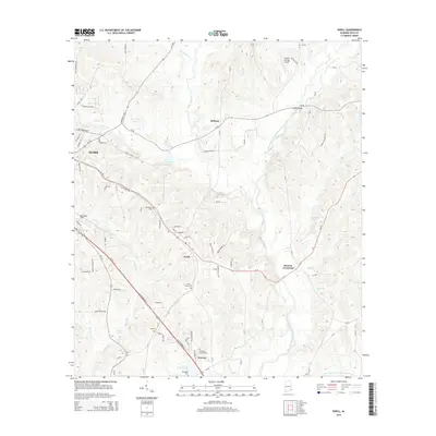
2014 Map of Ewell
USGS Topo · Published 2014About this map
The West Fork Choctawhatchee River and its tributary, the East Fork Choctawhatchee River, converge in this area of Southeast Alabama, shaping the development of rural crossroads and settlements. Local commerce and travel center around Ewell and Newton, while aviation infrastructure is evident at Blackwell Field and the Hidden Springs Airpark near the northern boundary.
Find a feature on this map
88 named features on this map. Tap any name to fly to it.
Don’t see what you’re looking for? This feature index may not catch every label — zoom into the map to look around manually.
Map Details
Editions of this 2014 Ewell Map
This is the sole edition of this map. No revisions or reprints were ever made.
Other maps of this area

1942 · Enterprise
USGS Topo · 1:125,000

1948 · Ozark
USGS Topo · 1:62,500

1950 · Ozark
USGS Topo · 1:62,500

1953 · Dothan
USGS Topo · 1:250,000

1954 · Dothan
USGS Topo · 1:250,000

1955 · Dothan
USGS Topo · 1:250,000

1960 · Ewell
USGS Topo · 1:24,000

1960 · Pinckard
USGS Topo · 1:24,000
1960 · Daleville
USGS Topo · 1:24,000
1960 · Ozark
USGS Topo · 1:24,000