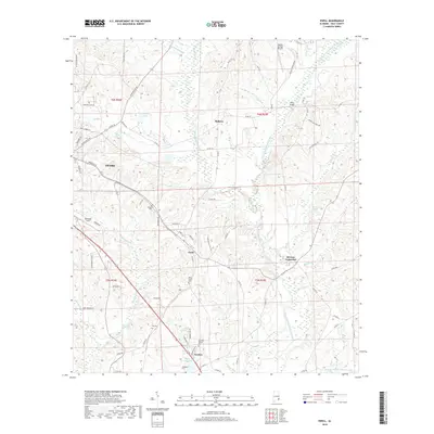
2018 Map of Ewell
USGS Topo · Published 2018About this map
Ozark and its southeastern rural surroundings are defined by the convergence of the West Fork Choctawhatchee River and the East Fork Choctawhatchee River. This 2018 survey reveals a landscape where aviation and agriculture meet, anchored by Blackwell Field in the west and Hidden Springs Airpark to the north. Smaller communities like Ewell, Mabson, and Newton are connected by a network of county roads that weave around numerous water features, including Johnsons Pond and the branching Klondike Creek.
Find a feature on this map
84 named features on this map. Tap any name to fly to it.
Don’t see what you’re looking for? This feature index may not catch every label — zoom into the map to look around manually.
Map Details
Editions of this 2018 Ewell Map
This is the sole edition of this map. No revisions or reprints were ever made.
Other maps of this area

1942 · Enterprise
USGS Topo · 1:125,000

1948 · Ozark
USGS Topo · 1:62,500

1950 · Ozark
USGS Topo · 1:62,500

1953 · Dothan
USGS Topo · 1:250,000

1954 · Dothan
USGS Topo · 1:250,000

1955 · Dothan
USGS Topo · 1:250,000

1960 · Ewell
USGS Topo · 1:24,000

1960 · Pinckard
USGS Topo · 1:24,000
1960 · Daleville
USGS Topo · 1:24,000
1960 · Ozark
USGS Topo · 1:24,000