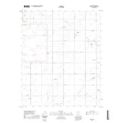
2023 Map of Ewing
USGS Topo · Published 2023About this map
Arroyo de Tajique and Arroyo de Manzano define the drainage patterns of this high-elevation landscape in central New Mexico. The terrain is characterized by a series of significant drainage channels, including the prominent Torreon Draw and Arroyo del Cuervo, which indicate the complex hydrology of the eastern foothills. Cultural history is anchored by the Mount Calvary Cem in the southwestern quadrant, serving as a vital landmark for genealogical research. The local road network, comprising routes like Akin Farm Rd and El Camino de Pedro, reflects a rural settlement pattern where family-named landholdings and farmsteads are connected by maintained county roads. This layout illustrates the persistence of traditional land use and grazing across the open stretches of the Estancia Valley watershed.
Find a feature on this map
43 named features on this map. Tap any name to fly to it.
Don’t see what you’re looking for? This feature index may not catch every label — zoom into the map to look around manually.
Map Details
Editions of this 2023 Ewing Map
This is the sole edition of this map. No revisions or reprints were ever made.
Other maps of this area

1917 · Estancia
USGS Topo · 1:125,000

1954 · Torreon
USGS Topo · 1:24,000

1954 · Tajique
USGS Topo · 1:24,000

1954 · Milbourn Ranch
USGS Topo · 1:24,000

1954 · Torreon
USGS Topo · 1:62,500

1954 · Socorro
USGS Topo · 1:250,000

1956 · Estancia
USGS Topo · 1:62,500

1956 · Mountainair
USGS Topo · 1:62,500

1958 · Socorro
USGS Topo · 1:250,000

1962 · Socorro
USGS Topo · 1:250,000