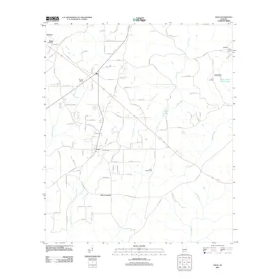
2011 Map of Excel
USGS Topo · Published 2011About this map
Excel and its surrounding countryside represent the quintessential rural landscape of southern Alabama as it appeared at the start of the 2010s. The map reveals a settlement pattern anchored by small junctions and historical communities such as Ollie, Mexboro, and Halls Crossroads. Water defines the local geography, with the winding paths of Big Escambia Creek and Brushy Creek cutting through the terrain, alongside smaller bodies like Kelly Lake.
Find a feature on this map
101 named features on this map. Tap any name to fly to it.
Don’t see what you’re looking for? This feature index may not catch every label — zoom into the map to look around manually.
Map Details
Editions of this 2011 Excel Map
This is the sole edition of this map. No revisions or reprints were ever made.
Other maps of this area

1953 · Andalusia
USGS Topo · 1:250,000

1957 · Andalusia
USGS Topo · 1:250,000

1971 · Range
USGS Topo · 1:24,000

1971 · Burnt Corn
USGS Topo · 1:24,000

1971 · Repton
USGS Topo · 1:24,000

1972 · Monroeville
USGS Topo · 1:24,000

1972 · Frisco City
USGS Topo · 1:24,000

1972 · Frisco City SE
USGS Topo · 1:24,000

1972 · Uriah East
USGS Topo · 1:24,000

1972 · Excel
USGS Topo · 1:24,000