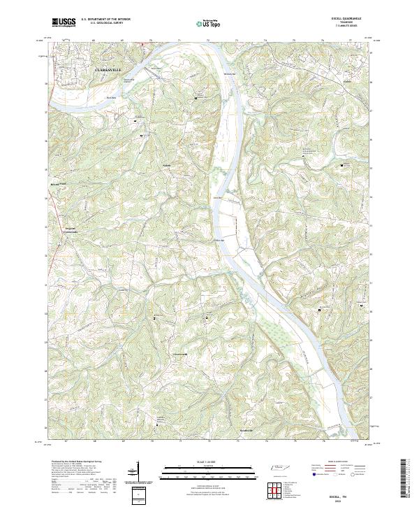
2022 Map of Excell
USGS Topo · Published 2022About this map
The Cumberland River carves a deep, winding path through this portion of Montgomery County, defining the landscape between the southern edge of Clarksville and the rural communities of Southside and Excell. This river-centric topography is marked by numerous bars and ripples, including Whiskey Bar, Coxs Bar, and Davis Ripple, reflecting a corridor long-utilized for transit and commerce. The uplands are dotted with small settlements such as Salem and Orgain Crossroads, where the distribution of family cemeteries like Edward Neblett Cem and Bagwell - Gill Cem speaks to generations of local land ownership.
Find a feature on this map
133 named features on this map. Tap any name to fly to it.
Don’t see what you’re looking for? This feature index may not catch every label — zoom into the map to look around manually.
Map Details
Editions of this 2022 Excell Map
This is the sole edition of this map. No revisions or reprints were ever made.
Other maps of this area

1944 · Clarksville
USGS Topo · 1:50,000

1951 · New Providence
USGS Topo · 1:24,000

1951 · Clarksville
USGS Topo · 1:24,000

1956 · Nashville
USGS Topo · 1:250,000

1957 · Cheatham Dam
USGS Topo · 1:24,000

1957 · Henrietta
USGS Topo · 1:24,000

1957 · Sango
USGS Topo · 1:24,000

1957 · New Providence
USGS Topo · 1:24,000

1957 · Clarksville
USGS Topo · 1:24,000
1957 · Clarksville
USGS Topo · 1:62,500