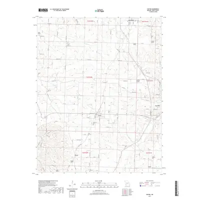
2017 Map of Exeter
USGS Topo · Published 2017About this map
Exeter and its surrounding rural townships in Barry County are documented here during a period of modern agricultural and civic continuity. The landscape is defined by the headwaters of Shoal Cr and Flat Cr, with numerous hollows like Gunter Hollow and Thomas Hollow shaping the local geography. Significant for genealogical research, the map identifies a high density of rural burial sites, including Maplewood Cem just south of Exeter, the remote True Love Cem, and Vineyard Cem. Settlement patterns follow the ridge lines and creek valleys, connecting smaller communities like Wayne, Butterfield, and Pasley to the larger seat at Cassville. Notable landmarks such as the Cassville Municipal Airport and unique natural features like Buffalo Bog and Talbert Spring provide specific points of interest for those studying the environmental and infrastructural layout of the Ozark plateau in the early 21st century.
Find a feature on this map
119 named features on this map. Tap any name to fly to it.
Don’t see what you’re looking for? This feature index may not catch every label — zoom into the map to look around manually.
Map Details
Editions of this 2017 Exeter Map
This is the sole edition of this map. No revisions or reprints were ever made.
Other maps of this area

1937 · Cassville
USGS Topo · 1:48,000

1941 · Rocky Comfort
USGS Topo · 1:62,500

1943 · Ritchey
USGS Topo · 1:62,500

1943 · Monett
USGS Topo · 1:62,500

1943 · Rocky Comfort
USGS Topo · 1:62,500

1944 · Cassville
USGS Topo · 1:62,500

1945 · Harrison
USGS Topo · 1:250,000

1949 · Harrison
USGS Topo · 1:250,000

1954 · Harrison
USGS Topo · 1:250,000

1954 · Tulsa
USGS Topo · 1:250,000