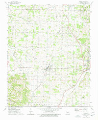
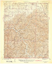
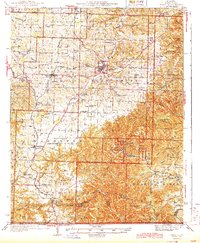
1974 Map of Exeter
USGS Topo · Published 1977About this map
The St Louis-San Francisco railroad line serves as a central artery for Barry County in the mid-1970s, connecting the towns of Butterfield and Exeter. The landscape is defined by its transition from the agricultural plateaus to the north and the increasingly complex drainages of the Flat Creek system to the east. A notable remnant of earlier transportation infrastructure, the Old Railroad Grade, cuts diagonally through the southwest, suggesting a shift in the local rail network over time.
Find a feature on this map
39 named features on this map. Tap any name to fly to it.
Don’t see what you’re looking for? This feature index may not catch every label — zoom into the map to look around manually.
Map Details
Editions of this 1974 Exeter Map
This is the sole edition of this map. No revisions or reprints were ever made.
Other maps of this area
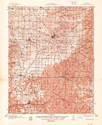
1937 · Cassville
USGS Topo · 1:48,000
1941 · Rocky Comfort
USGS Topo · 1:62,500

1943 · Ritchey
USGS Topo · 1:62,500
1943 · Monett
USGS Topo · 1:62,500
1943 · Rocky Comfort
USGS Topo · 1:62,500
1944 · Cassville
USGS Topo · 1:62,500

1945 · Harrison
USGS Topo · 1:250,000

1949 · Harrison
USGS Topo · 1:250,000

1954 · Harrison
USGS Topo · 1:250,000

1954 · Tulsa
USGS Topo · 1:250,000