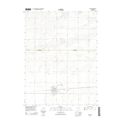
2014 Map of Exeter
USGS Topo · Published 2014About this map
The village of Exeter anchors this 2014 survey of the Nebraska plains, positioned along the southern corridor where Us-6 and E 6 HWY provide the primary east-west transit. The town's grid is clearly defined by local thoroughfares such as N Exeter Ave and E Seneca St, with the Exeter Cem situated just to the north along Cemetery Rd.
Find a feature on this map
31 named features on this map. Tap any name to fly to it.
Don’t see what you’re looking for? This feature index may not catch every label — zoom into the map to look around manually.
Map Details
Editions of this 2014 Exeter Map
This is the sole edition of this map. No revisions or reprints were ever made.
Other maps of this area

1898 · York
USGS Topo · 1:125,000

1899 · York
USGS Topo · 1:125,000

1934 · Utica
USGS Topo · 1:62,500

1937 · Utica
USGS Topo · 1:62,500

1955 · Lincoln
USGS Topo · 1:250,000

1957 · Lincoln
USGS Topo · 1:250,000

1958 · Lincoln
USGS Topo · 1:250,000
1966 · Friend
USGS Topo · 1:24,000
1966 · Beaver Crossing
USGS Topo · 1:24,000
1966 · Friend SE
USGS Topo · 1:24,000