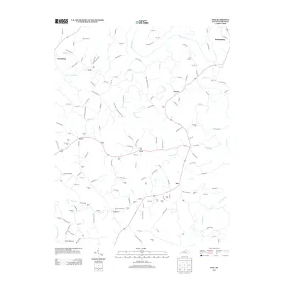
2013 Map of Exie
USGS Topo · Published 2013About this map
Greensburg stands at the northeastern edge of this Green County landscape, where the Green River bends south toward the small settlements of Thurlow and Exie. The terrain is defined by a dense network of family-named cemeteries and rural churches, such as Mount Lebanon Church, indicating a deeply rooted community structure throughout the early 21st century. The map reveals how local transit follows the winding paths of Russell Cr and Greasy Cr, connecting unincorporated hamlets like Grab and Donansburg. Genealogists will find particular value in the high concentration of burial sites, including the Akin Cem, Judd Cem, and Sandidge Cem, which are scattered among the ridges and creek valleys. To the southwest, Liletown and Little Barren sit near the headwaters of the Little Barren River, marking the transition into the neighboring county's hills.
Find a feature on this map
147 named features on this map. Tap any name to fly to it.
Don’t see what you’re looking for? This feature index may not catch every label — zoom into the map to look around manually.
Map Details
Editions of this 2013 Exie Map
This is the sole edition of this map. No revisions or reprints were ever made.
Other maps of this area

1953 · Gradyville
USGS Topo · 1:24,000

1953 · Sulphur Well
USGS Topo · 1:24,000

1953 · Hudgins
USGS Topo · 1:24,000

1953 · Summersville
USGS Topo · 1:24,000

1953 · Exie
USGS Topo · 1:24,000

1953 · Gresham
USGS Topo · 1:24,000

1953 · Center
USGS Topo · 1:24,000

1953 · East Fork
USGS Topo · 1:24,000

1954 · Greensburg
USGS Topo · 1:24,000

1957 · Winchester
USGS Topo · 1:250,000