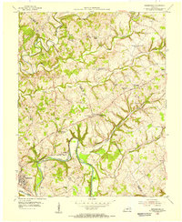
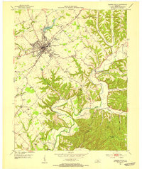
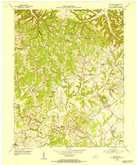
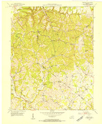
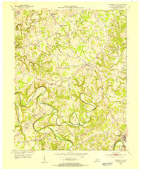
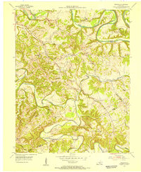
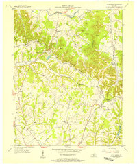
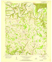
1954 Map of Greensburg
USGS Topo · Published 1955About this map
The Green River carves a dramatic oxbow around the land known as Cox Bend, defining the rural landscape of Green and Taylor Counties in the mid-1950s. The county seat of Greensburg sits at the southwestern edge of the survey, where the river's winding course creates several distinct islands including Russell Island and Marcum Island. This area is characterized by a high density of rural social infrastructure, with numerous small schoolhouses like Friendship Sch and Meadow Creek Sch serving local farm families before the widespread consolidation of the late 20th century.
Find a feature on this map
54 named features on this map. Tap any name to fly to it.
Don’t see what you’re looking for? This feature index may not catch every label — zoom into the map to look around manually.
Map Details
Editions of this 1954 Greensburg Map
This is the sole edition of this map. No revisions or reprints were ever made.
Other maps of this area
1953 · Campbellsville
USGS Topo · 1:24,000
1953 · Saloma
USGS Topo · 1:24,000
1953 · Hibernia
USGS Topo · 1:24,000
1953 · Summersville
USGS Topo · 1:24,000

1953 · Exie
USGS Topo · 1:24,000
1953 · Gresham
USGS Topo · 1:24,000
1953 · Spurlington
USGS Topo · 1:24,000
1953 · Cane Valley
USGS Topo · 1:24,000

1957 · Winchester
USGS Topo · 1:250,000

1960 · Winchester
USGS Topo · 1:250,000