
1953 Map of Spurlington
USGS Topo · Published 1955About this map
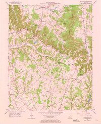
Muldraugh Hill dominates the landscape of this 1953 survey, creating a dramatic divide between the drainage of Big Pitman Creek and the northern waters of Rolling Fork. The settlement patterns here reflect the complex topography of the Dividing Ridge, with rural communities like Jessietown and Finley situated along the high ground of the ridgeline. The Louisville and Nashville railroad winds through the eastern portion of the map, serving the community of Spurlington and the milling operations at Mill Gap. Genealogists will find a wealth of family-named landmarks and institutions, including the Muldraugh Hill Ch, Brockman Cem, and St Francis Cem, alongside numerous small schoolhouses like Pitman Valley Sch and Chestnut Grove Sch that served these isolated hill communities before mid-century consolidation.
Find a feature on this map
51 named features on this map. Tap any name to fly to it.
Don’t see what you’re looking for? This feature index may not catch every label — zoom into the map to look around manually.
Map Details
Editions of this 1953 Spurlington Map
3 editions found
Other maps of this area

1952 · Mannsville
USGS Topo · 1:24,000

1952 · Bradfordsville
USGS Topo · 1:24,000

1953 · Campbellsville
USGS Topo · 1:24,000

1953 · Saloma
USGS Topo · 1:24,000

1953 · Lebanon East
USGS Topo · 1:24,000

1953 · Raywick
USGS Topo · 1:24,000

1953 · Lebanon West
USGS Topo · 1:24,000

1953 · Bradfordsville
USGS Topo · 1:24,000

1954 · Greensburg
USGS Topo · 1:24,000

1957 · Winchester
USGS Topo · 1:250,000