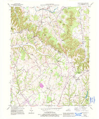
1953 Map of Spurlington
USGS Topo · Published 1995About this map
Muldraugh Hill dominates the northern landscape of Taylor County, creating a dramatic topographical break where the uplands of Shingle Knob and Paine Knob overlook the narrow valley of the Rolling Fork. This 1953 survey captures the rural character of the region during a period of established community life centered on small schoolhouses and country parishes. The map reveals a dense network of family history markers, from the St Francis Cem near Spurlington to the Feather Cem in the west, illustrating how the terrain dictated settlement patterns along the fingers of Pitman Creek and Trace Fork.
Find a feature on this map
47 named features on this map. Tap any name to fly to it.
Don’t see what you’re looking for? This feature index may not catch every label — zoom into the map to look around manually.
Map Details
Editions of this 1953 Spurlington Map
3 editions found
Other maps of this area

1952 · Mannsville
USGS Topo · 1:24,000

1952 · Bradfordsville
USGS Topo · 1:24,000

1953 · Campbellsville
USGS Topo · 1:24,000

1953 · Saloma
USGS Topo · 1:24,000

1953 · Lebanon East
USGS Topo · 1:24,000

1953 · Raywick
USGS Topo · 1:24,000

1953 · Spurlington
USGS Topo · 1:24,000

1953 · Lebanon West
USGS Topo · 1:24,000

1953 · Bradfordsville
USGS Topo · 1:24,000

1954 · Greensburg
USGS Topo · 1:24,000