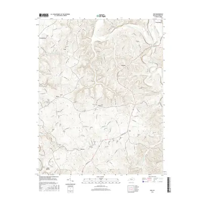
2016 Map of Exie
USGS Topo · Published 2016About this map
The Green River meanders across the northern reaches of this landscape, carving a deep valley through the limestone terrain of Green County. Small rural hubs such as Exie, Liletown, and Grab anchor a dense network of country roads, where the settlement pattern is closely tied to the ridges and creek bottoms. The area's social history is recorded in numerous small family and community burial grounds, including the Judd Cem, Maple Hill Cem, and Akin Cem, which are scattered throughout the hills. In the southeast, Russell Creek and its tributary, S Fork Russell Cr, define the drainage toward the Little Barren River. The map reveals a deeply etched topography of knobs and hollows, characteristic of south-central Kentucky, where narrow ridges like those along W Buckner Hill Rd and Edmonton Rd serve as the primary corridors for development and transport between larger centers like Greensburg.
Find a feature on this map
122 named features on this map. Tap any name to fly to it.
Don’t see what you’re looking for? This feature index may not catch every label — zoom into the map to look around manually.
Map Details
Editions of this 2016 Exie Map
This is the sole edition of this map. No revisions or reprints were ever made.
Other maps of this area

1953 · Gradyville
USGS Topo · 1:24,000

1953 · Sulphur Well
USGS Topo · 1:24,000

1953 · Hudgins
USGS Topo · 1:24,000

1953 · Summersville
USGS Topo · 1:24,000

1953 · Exie
USGS Topo · 1:24,000

1953 · Gresham
USGS Topo · 1:24,000

1953 · Center
USGS Topo · 1:24,000

1953 · East Fork
USGS Topo · 1:24,000

1954 · Greensburg
USGS Topo · 1:24,000

1957 · Winchester
USGS Topo · 1:250,000