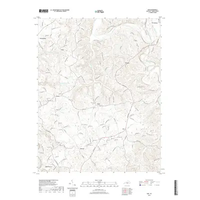
2019 Map of Exie
USGS Topo · Published 2019About this map
Green River and Russell Creek define the drainage of this portion of Green County, where small agricultural communities and family burial grounds are distributed across the upland divides. The settlement at Greensburg sits in the northeast corner of this 2019 survey, while rural crossroads like Donansburg, Pierce, and Exie anchor the surrounding countryside. This landscape is dense with genealogical markers, containing dozens of named family plots such as Judd Cem, Akin Cem, and Maple Hill Cem. The road network, including the Edmonton Rd and numerous namesake routes like Shirrell Cemetery Rd, follows the winding topography between watercourses like Greasy Cr and Trammell Cr. The distribution of these features reflects a long-standing pattern of localized settlement centered on river proximity and family landholdings in central Kentucky.
Find a feature on this map
130 named features on this map. Tap any name to fly to it.
Don’t see what you’re looking for? This feature index may not catch every label — zoom into the map to look around manually.
Map Details
Editions of this 2019 Exie Map
This is the sole edition of this map. No revisions or reprints were ever made.
Other maps of this area

1953 · Gradyville
USGS Topo · 1:24,000

1953 · Sulphur Well
USGS Topo · 1:24,000

1953 · Hudgins
USGS Topo · 1:24,000

1953 · Summersville
USGS Topo · 1:24,000

1953 · Exie
USGS Topo · 1:24,000

1953 · Gresham
USGS Topo · 1:24,000

1953 · Center
USGS Topo · 1:24,000

1953 · East Fork
USGS Topo · 1:24,000

1954 · Greensburg
USGS Topo · 1:24,000

1957 · Winchester
USGS Topo · 1:250,000