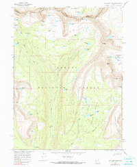
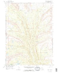
1967 Map of Explorer Peak
USGS Topo · Published 1990About this map
Explorer Peak stands as the centerpiece of this high-elevation mountain landscape, straddling the boundary between the Wasatch National Forest and Ashley National Forest. This 1967 survey documents an intricate network of alpine water bodies and drainage basins, notably the Ottoson Basin and Squaw Basin. The drainage of Rock Creek and its various forks organize the terrain, while high passes such as Dead Horse Pass and Cyclone Pass provide the primary transit points across the ridges. A dense concentration of named lakes, including the uniquely titled Jack and Jill Lakes, Sea Lion Lake, and Shamrock Lake, suggests a landscape shaped by glacial activity. The area is defined entirely by its natural hydrology and topography, with human presence marked only by a system of primitive routes like the W Fk Blacks Fork Trail and numerous unnamed pack trails.
Find a feature on this map
50 named features on this map. Tap any name to fly to it.
Don’t see what you’re looking for? This feature index may not catch every label — zoom into the map to look around manually.
Map Details
Editions of this 1967 Explorer Peak Map
3 editions found
Other maps of this area

1885 · Uinta
USGS Topo · 1:250,000

1901 · Hayden Peak
USGS Topo · 1:125,000

1903 · Hayden Peak
USGS Topo · 1:125,000

1954 · Salt Lake City
USGS Topo · 1:250,000

1958 · Salt Lake City
USGS Topo · 1:250,000

1960 · Salt Lake City
USGS Topo · 1:250,000
1967 · Kidney Lake
USGS Topo · 1:24,000

1967 · Explorer Peak
USGS Topo · 1:24,000
1967 · Mount Lovenia
USGS Topo · 1:24,000
1967 · Oweep Creek
USGS Topo · 1:24,000