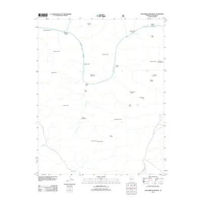
2012 Map of Explorers Monument
USGS Topo · Published 2012About this map
The Colorado River carves a deep path through Coconino County in this 2012 survey, revealing the complex geological stair-steps of the Grand Canyon’s south rim. The landscape is defined by massive topographic features bearing diverse cultural names, from the ancient Aztec Amphitheater and Montezuma Point to the Darwin Plateau and Evolution Amphitheater. Navigational hazards like Hakatai Rapids and Walthenberg Rapids mark the river’s course, while water sources such as Mystic Spring and Seep Spring provide critical points in an otherwise arid environment.
Find a feature on this map
39 named features on this map. Tap any name to fly to it.
Don’t see what you’re looking for? This feature index may not catch every label — zoom into the map to look around manually.
Map Details
Editions of this 2012 Explorers Monument Map
This is the sole edition of this map. No revisions or reprints were ever made.
Other maps of this area

1886 · Kaibab
USGS Topo · 1:250,000

1953 · Grand Canyon
USGS Topo · 1:250,000

1957 · Grand Canyon
USGS Topo · 1:250,000

1958 · Grand Canyon
USGS Topo · 1:250,000

1960 · Grand Canyon
USGS Topo · 1:250,000

1962 · Kanab Point
USGS Topo · 1:62,500

1962 · Havasupai Point
USGS Topo · 1:62,500
1962 · Powell Plateau
USGS Topo · 1:62,500

1962 · Supai
USGS Topo · 1:62,500

1984 · Grand Canyon
USGS Topo · 1:100,000