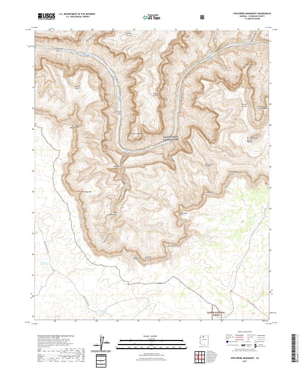
2021 Map of Explorers Monument
USGS Topo · Published 2021About this map
Grand Canyon National Park dominates this section of the Arizona landscape, where the Colorado River carves through the earth at Granite Gorge. The mapping reveals a series of expansive geological features named for historical figures and ancient civilizations, such as De Vaca Terrace, Marcos Terrace, and Montezuma Point. Significant river navigation points include the Hakatai Rapids and Waltenberg Rapids, which mark the river's descent. To the south, the terrain transitions into the Kaibab National Forest, accessible by routes like Topocoba Hilltop Rd. For researchers, the map provides precise locations for isolated water sources critical to the area's history, including Mexican Jack Tank and Hidden Log Tank, set against the backdrop of massive formations like Mt Huethawali Darwin Plateau and the Explorers Monument.
Find a feature on this map
49 named features on this map. Tap any name to fly to it.
Don’t see what you’re looking for? This feature index may not catch every label — zoom into the map to look around manually.
Map Details
Editions of this 2021 Explorers Monument Map
This is the sole edition of this map. No revisions or reprints were ever made.
Other maps of this area

1886 · Kaibab
USGS Topo · 1:250,000

1953 · Grand Canyon
USGS Topo · 1:250,000

1957 · Grand Canyon
USGS Topo · 1:250,000

1958 · Grand Canyon
USGS Topo · 1:250,000

1960 · Grand Canyon
USGS Topo · 1:250,000

1962 · Kanab Point
USGS Topo · 1:62,500

1962 · Havasupai Point
USGS Topo · 1:62,500
1962 · Powell Plateau
USGS Topo · 1:62,500

1962 · Supai
USGS Topo · 1:62,500

1984 · Grand Canyon
USGS Topo · 1:100,000